Flood watches expand as saturated ground raises landslide risk
Photo credit: Elena Takmakova/Unsplash.com
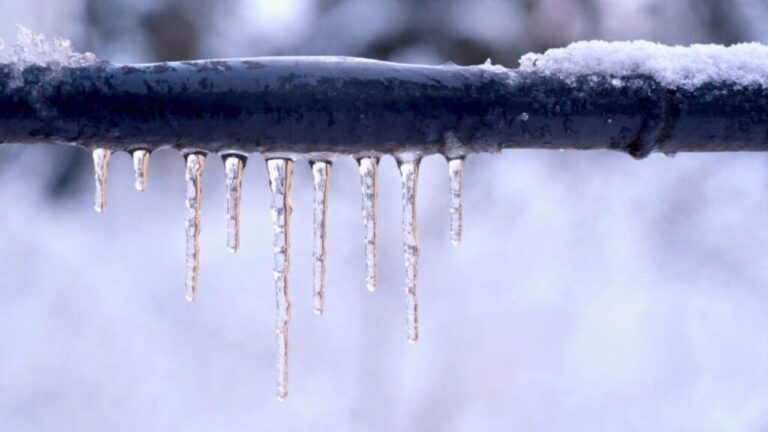
Relentless Pacific storms are soaking the West Coast, and the ground is running out of capacity to absorb more water. As flood watches spread from California into the Pacific Northwest, you are not just looking at swollen rivers and ponding on roads, but a growing threat that hillsides could give way with little warning.
When soil stays saturated for days, even a modest new burst of rain can be enough to trigger debris flows, mudslides, and sudden slope failures. Understanding where the risk is highest, how it behaves, and what you can do in the next few days can make the difference between a close call and a disaster.
Flood watches widen as storms keep coming
You are now seeing a patchwork of flood alerts knit into a nearly continuous corridor from Southern California to the Canadian border. The National Weather Service has expanded a Flood Watch for all southwest Washington and northwest Oregon, warning that an atmospheric river will keep dumping rain on already soaked terrain. Farther south, forecasters in Eureka say a Flood Watch is in effect from Tuesday evening through Friday evening for Del Norte, Humboldt, Trinity, Mendocino and Lake counties, underscoring how long this pattern is expected to last. In Northern California’s interior, a separate advisory stresses that it only takes 6 inches of moving water to knock you off your feet and urges you to move to the highest ground possible and call 911 if you are trapped by rising water, a reminder carried in a regional alert.
In Southern California, the pattern is similar, just with warmer air and more pavement. The National Weather Service has issued flood watches for portions of Southern California Edison’s service territory, warning customers that saturated soils and additional rain could topple trees and power lines and that crews are preparing in case any weather related outages occur, according to a utility briefing titled “Here Comes Santa … and Showers” that notes The National Weather Service alerts. Even as a powerful holiday storm winds down, flooding remains a concern across parts of Southern California Friday morning, with forecasters warning that runoff will continue to move through creeks and storm drains, a point underscored in a Full account of lingering impacts in Los Angeles and surrounding communities.
Why saturated ground turns hillsides unstable
From a distance, a green hillside looks solid, but once storms stack up, the physics inside that slope change in ways you need to take seriously. Intense rainfall drives water into the pores between grains of soil and rock, and as that pore water pressure rises, it pushes particles apart, reducing the friction that normally holds a slope in place, a process described in detail in a hazard brief that notes how Intense storms and high Soil and rock moisture can destabilize slopes. Once the balance tips, gravity does the rest, and what looked like a stable bluff can suddenly move as a debris flow that behaves more like wet concrete than loose dirt.
Western Washington’s experience in recent weeks shows how long that instability can linger. Local experts there warn that even after the heaviest rain passes, you should give slopes roughly two weeks without substantial new precipitation before assuming they have drained and restabilized, because the counteracting force that resists movement is located deep in the soil column and takes time to recover, a point highlighted in a discussion of how landslide risk in western Washington persists as Dec storms continue. For you, that means the danger does not end when the radar quiets; it ends when the ground has had time to shed the water now weighing it down.
California’s layered vulnerability to slides and floods
If you live in California, you are sitting at the intersection of steep topography, aggressive development, and a storm track that can flip from drought to deluge in a single season. Heavy rain from an atmospheric river is already causing flooding and road closures across California, with Heavy downpours overwhelming drainage in some corridors. As each new storm arrives in another, Social speculation often follows about cloud seeding, but the more immediate reality is that natural atmospheric rivers are delivering enough water to saturate slopes from the coast to the Sierra.
That saturation is exactly what makes the state primed for landslides. Analysts who study extreme weather impacts note that Landslides carry away roads with California‘s heavy rain when the surface runoff becomes channelized, carving into slopes and undercutting foundations. Once that erosion starts, it can redirect water into new gullies, further destabilizing hillsides and sending debris into neighborhoods that may never have seen a slide before, a pattern that should prompt you to look beyond historic experience and pay attention to current soil conditions.
Southern California: from flash floods to hillside failures
In Southern California’s urban belt, the same storm can hit you twice, first as a flash flood and then as a slope failure. Earlier this season, The National Weather Service issued a flash flood warning for Northwestern Alameda County and West Central Contra Costa County at the height of a heavy downpour, and that same storm triggered a landslide at Grizzly Peak above Berkeley, a reminder that steep slopes above dense neighborhoods can fail with little notice, as documented in a report on how The National Weather Service alert coincided with the slide. In the Los Angeles Basin and nearby foothills, you face a similar pairing of low lying flood risk and unstable canyon walls.
Local emergency planners warn that, Due to heavy rains, soil erosion in hillside areas can be accelerated, resulting in loss of soil support beneath high voltage transmission towers and other infrastructure that are located in vulnerable soils, a scenario laid out in Sierra Madre’s guidance on Due mudflows and flood hazards. If you live in foothill communities from Ventura to Santa Barbara and inland toward Kern County, that means you should treat every new round of rain as a test of both your drainage and your slopes, especially where roads cut into hillsides or where older retaining walls are already cracked.
Pacific Northwest: flood watch and landslide alerts in tandem
Farther north, you are dealing with a different climate but the same basic problem: too much water in too little time. The National Weather Service has issued a broad Flood Watch for all southwest Washington and northwest Oregon, warning that rivers, creeks, and urban drainage systems will struggle to keep up as an atmospheric river parks over the region, a concern spelled out in the advisory that notes a Washington and Oregon corridor under watch. That same moisture is soaking the Coast Range and Cascade foothills, where deep, forested soils can become unstable once they are fully saturated.
State agencies along the central Oregon coast are blunt about what that means for you. They urge residents to Monitor weather updates via radio, TV, or weather.gov/pqr, and to watch for signs of slope movement such as new cracks, leaning trees, or doors that suddenly stick, guidance captured in a coastal bulletin that emphasizes the need to Monitor changing conditions. With southwest Washington and northwest Oregon both under prolonged rain, you should assume that any steep, previously logged, or road cut slope is at elevated risk until the pattern breaks and the soils have time to drain.
North Coast and interior: wind, power, and remote communities
On California’s North Coast and in its rugged interior, the hazards stack up in ways that can leave you isolated just when you need help most. According to the National Weather Service in According to the National Weather Service in National Weather Service Eureka, the current Flood Watch from Tuesday through Friday for Del Norte, Humboldt, Trinity, Mendocino and Lake counties is paired with a warning that more heavy storms are expected after only a brief lull, meaning rivers and slopes will not get much of a break. In these counties, narrow highways often hug steep canyon walls, so a single slide can cut off entire valleys until crews can safely clear debris.
Local forecasts in Trinity County go a step further, flagging how multiple hazards can converge. A recent outlook notes Wind and power outage risk as a key concern, with Forecast models showing a 30 percent chance of damaging winds Tuesday night into Christma, a combination that could topple trees into saturated slopes and onto power lines, as described in a Wind and hazard briefing that highlights the Forecast for Tuesday into Christma. For you, that means planning for the possibility that a slide could block your road at the same time a power outage knocks out cell towers, making it even more important to have a battery powered radio and a clear evacuation plan.
Burn scars and debris flows: when fire zones flood fast
If you live below a recent wildfire burn scar, your risk profile is even sharper than your neighbors’. Federal forecasters warn that recent wildfires will have lasting effects on the landscape, and create a heightened risk of flooding for years to come, because vegetation that once absorbed and slowed rainfall is gone and the soil can become water repellent, a dynamic explained in guidance that notes how Locations downstream of burns can see sudden flash flooding. When intense rain hits those slopes, water races over the surface, picking up ash, rocks, and logs, and can funnel into canyons as a fast moving debris flow that behaves more like a slurry than a typical flood.
In Southern California’s foothills, that risk is layered on top of the broader flood watches already in place. Utility planners working with Southern California Edison have been warning customers that The National Weather Service has issued flood watches for portions of the company’s service area and that crews are preparing in case any weather related outages occur, a message embedded in the The National Weather Service briefing. If your home sits below a canyon that burned in the last few years, you should treat any forecast of heavy rain as a trigger to move vehicles out of the flow path, clear gutters and drains, and be ready to leave quickly if you hear rocks clattering or see muddy water suddenly rising.
How to read the alerts and act on them
With so many advisories flying around, your first job is to know which ones apply to you and what they actually mean. The National Weather Service’s main portal at weather.gov lets you plug in your ZIP code to see whether you are under a Flood Watch, Flood Warning, or more localized alerts such as debris flow advisories, and regional pages like weather.gov/pqr, referenced in coastal Oregon guidance, drill down even further. Local outlets on the North Coast remind residents that More information and local warnings are available at weather.gov, underscoring that the most current details on river levels, road closures, and slide risks will show up there first, a point made explicitly in a Mendocino County update that notes More resources online.
Once you know your status, the next step is to translate that into action. A Flood Watch means conditions are favorable, so you should secure outdoor items, clear drains, and review your evacuation routes, especially if you live below a slope or near a creek. A Flood Warning or flash flood warning means flooding is happening or imminent, and you should move to higher ground immediately, never drive through water of unknown depth, and remember that it only takes 6 inches of moving water to knock you off your feet, as the Dec advisory for Northern California stresses. For landslides, there may be no formal warning, so you should treat new cracks, tilting fences, or unusual sounds on a rainy night as your own early alert and move out of harm’s way.
Practical steps you can take before the next band of rain
Even if you cannot change the weather, you can change how exposed you are to it. Start by walking your property during a dry break and looking at where water naturally wants to go; if you see it pooling near your foundation or flowing straight toward a downhill neighbor, you should clear debris from gutters, downspouts, and yard drains so that runoff is directed safely away. In hillside neighborhoods, local guidance on mudflows notes that soil erosion can be accelerated beneath critical infrastructure when heavy rains hit vulnerable soils, as the Sierra Madre bulletin on mudflows/flood hazards explains, and the same principle applies to your retaining walls, decks, and driveways.
You should also think beyond your property line. If you commute along a canyon road or live in a community perched on a bluff, check local emergency plans and sign up for text alerts so you are not caught off guard by a closure or evacuation order. Coastal Oregon officials urge residents to monitor weather updates via radio, TV, or weather.gov/pqr, and that advice travels well: a battery powered NOAA weather radio, a charged power bank for your phone, and a go bag with essentials can buy you time if a slide blocks your exit or a flood cuts power, as highlighted in the coastal landslide advisory. With flood watches expanding and the ground already saturated, the most effective move you can make is to act as if the next storm will test every weak point in your landscape and your routine, and to shore them up now rather than after the hillside starts to move.