The weather pattern that’s setting up a messy start to 2026
A volatile mix of Arctic air, Pacific moisture, and shifting global patterns is lining up to give you a messy, high‑impact start to 2026. Instead of a clean flip of the calendar, you are staring at a tangle of freezing rain, snow, and sharp temperature swings that could disrupt travel, power, and daily routines across large parts of the United States. The same pattern that is driving the New Year’s blast is also poised to linger into January, shaping how winter feels long after the confetti is swept away.
Arctic air sets the stage for a turbulent New Year
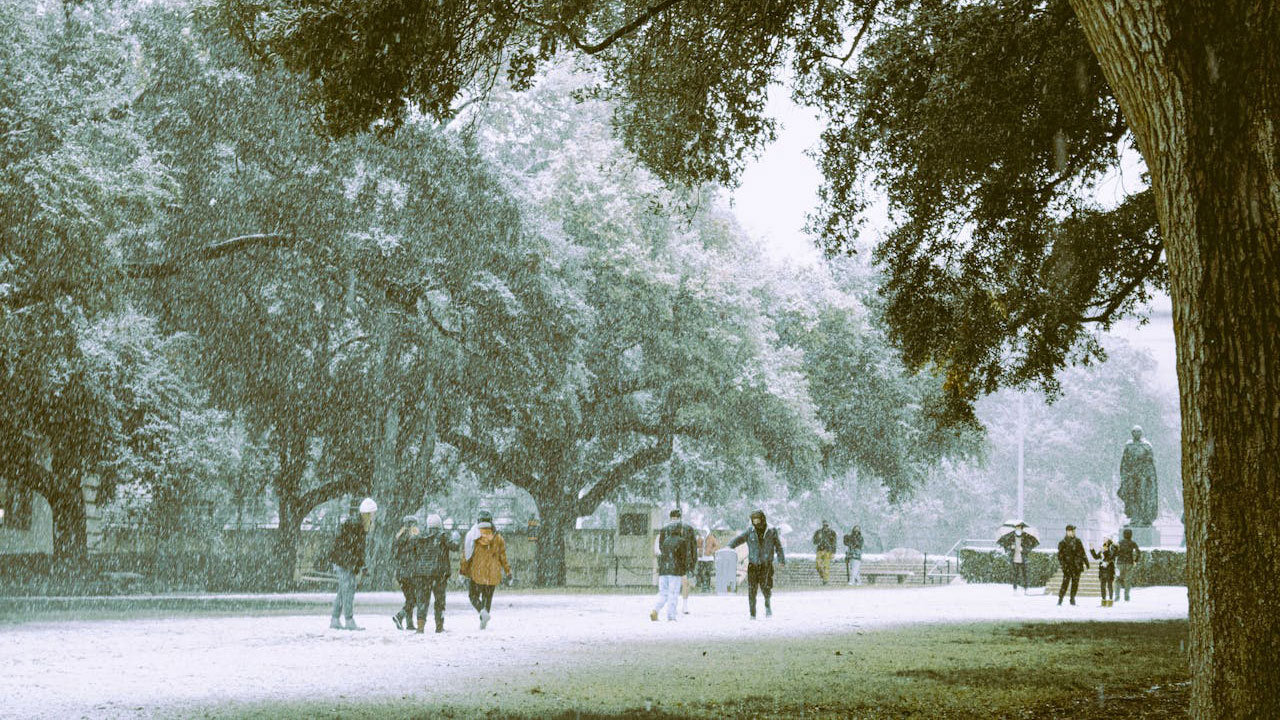
The backbone of the early‑2026 pattern is a surge of frigid Arctic air spilling south from Canada into the central and eastern United States. Forecasts describe a fresh blast of bone‑chilling cold that will drop temperatures well below seasonal norms and support snow for parts of the central and eastern U.S. before 2026 even arrives, with the cold air mass described as a “Bone‑chilling Arctic” outbreak that reinforces winter’s grip. That same Arctic reservoir will still be in place as the calendar turns, keeping wind chills harsh and making any moisture that rides over the top of the cold dome more likely to fall as snow or ice rather than rain, especially where the shallow cold hugs the surface.
Because this air mass is dense and slow to move, you should expect it to undercut milder air aloft and create sharp temperature contrasts from one region to the next. That contrast is a classic recipe for active storm tracks, and it is why forecasters are already flagging the potential for snow bands and icy mix from the Plains into the Appalachians as the “Bone‑chilling Arctic cold” pattern evolves across the central and eastern U.S. in the final days of Dec, with the cold lingering even after high winds ease. When you combine that entrenched chill with incoming storm systems, the stage is set for a messy, not mild, entrance into 2026.
Freezing rain and thunderstorms: why the transition zone is so dangerous
While some of you will be locked in snow and deep cold, others will sit in a treacherous transition zone where warm, moist air rides over subfreezing ground. In that corridor, forecasters Expect freezing rain, thunderstorms, and cold weather across the U.S. as 2026 rolls in, a combination that can glaze roads and power lines while lightning flashes overhead. Meteorologists warn that different regions will see very different effects from this storm, with some areas dealing with slick ice and others facing heavy rain and rumbles of thunder on the warm side of the boundary.
This kind of setup is particularly disruptive because it hits multiple systems at once. Freezing rain can snap tree limbs and weigh down power infrastructure, while nearby communities just a few miles away may be contending with localized flooding or severe thunderstorms. As the storm taps into the same Arctic air mass that is driving the bone‑chilling cold, the overlap of subfreezing surface temperatures and above‑freezing air aloft becomes the key ingredient for ice, which is why Meteorologists are emphasizing that you should Expect a patchwork of hazards rather than a single, uniform winter storm as the New Year pattern unfolds.
New York’s New Year’s Eve hints at the broader pattern
If you are heading to New York City for the iconic ball drop, the local forecast offers a snapshot of the larger atmospheric setup. Guidance for those planning to be in New York City for the New Year Eve celebration in Time Square points to a chilly morning and a cold, unsettled feel, even if the worst of the wintry mix stays west or north. That kind of marginal, raw pattern, cold enough for discomfort but not locked into deep snow, is exactly what you would expect along the eastern edge of a sprawling Arctic air mass that is strongest farther inland.
The details over Manhattan matter less than what they reveal about the jet stream overhead. A storm track close enough to bring clouds, gusty breezes, and the threat of showers to New York City for the New Year Eve festivities in Time Square, but not far enough south to unleash a coastal blizzard, signals a pattern where the core of the cold is displaced toward the interior. That aligns with broader forecasts of bone‑chilling conditions in the central and eastern U.S., while coastal cities like New York City for the big New Year Eve ball drop ride the boundary between true Arctic air and milder Atlantic influence, a boundary that will keep shifting as 2026 begins.
Cold returns across the U.S. and Canada as the polar vortex flexes
Zooming out, the messy start to 2026 is tied to a larger scale return of cold across North America. Latest model guidance highlights a surprising Cold return over the U.S. and Canada, expected to last into January, as a strong lobe of the polar vortex drops south and reinforces the chill. By the end of the year and into 2026, that circulation pattern is projected to keep feeding cold air into Canada and the United States, preventing a quick warmup and sustaining the temperature contrasts that fuel frequent storm systems.
For you, that means the New Year’s blast is unlikely to be a one‑and‑done event. Instead, the same dynamics that are sending Arctic air into the central and eastern states will keep reloading the pattern, with fresh shots of cold spilling out of Canada and interacting with Pacific and Gulf moisture. The result is a conveyor belt of disturbances that can bring snow, ice, or rain depending on your exact location relative to the cold dome, a scenario that the “Latest forecasts” of a Cold return over Canada and the United States describe as a key driver of Winter conditions as 2026 gets underway.
Short‑term hazards: what official outlooks are flagging
As the pattern locks in, federal forecasters are already mapping out where the biggest early‑January hazards are most likely. The National Weather Service is using its central portal at weather.gov to highlight winter storm warnings, ice storm alerts, and wind chill advisories tied to the Arctic outbreak and its associated storms. For a broader view, the Climate Prediction Center’s short‑range hazard products outline areas at risk for heavy snow, significant icing, and extreme cold in the coming days, giving you a sense of how the messy pattern may evolve region by region.
Those hazard outlooks are distilled into a national map that shows where forecasters see the greatest threat of impactful weather in the 3‑ to 7‑day window. The Week 2 hazards outlook, available through the CPC’s dedicated threats page, flags zones where prolonged cold, heavy precipitation, or both are favored, helping you anticipate whether your area is more likely to see snow, ice, or a cold rain. By checking the CPC’s threats outlook alongside local NWS discussions, you can better understand how the national pattern translates into specific risks for your community as 2026 begins.
January’s broader setup: a winter that “rewards patience”
Beyond the first chaotic week, seasonal forecasters are framing January as a month where winter gradually tightens its grip rather than arriving all at once. One long‑range outlook describes “The January Context” as a period when Winter Returns in earnest, noting that January is climatologically the coldest month of the year and that the evolving pattern is one that “rewards patience” for those waiting on sustained cold and snow. In other words, the messy start you see around New Year’s is part of a longer arc that favors repeated cold shots and periodic winter storms instead of a quick thaw.
For you, that means planning for a month where brief warmups are likely to be interrupted by renewed intrusions of Arctic air, especially across the interior East and parts of the South. The same analysis of the January 2026 Forecast Outlook emphasizes that the pattern is supportive of recurring winter weather events, even if the exact timing and track of each storm will depend on shorter‑term features. If you live in a snow‑starved area, the message from “The January Context” and “Winter Returns” is that patience may be rewarded later in the month, as the background state continues to favor cold and active weather.
Regional winners and losers: who faces the “big freeze” and who stays mixed
Not every region will experience this pattern in the same way. Seasonal guidance aimed at the 2025–2026 cold season points to a pronounced “Big freeze” risk in January for the Midwest, Ohio, and Michigan, with particular emphasis on the Great Lakes corridor. In the Great Lakes, Ohio Valley, and Midwest region, including Illinois, Indiana, and Wisconsin, the outlook calls for a longer winter of cold plus snow in the north, suggesting that you in those states should brace for repeated Arctic intrusions and lake‑enhanced snow as the pattern cycles.
Farther south and east, the same broad setup may translate into more mixed precipitation events rather than pure snow. If you live along the lower Ohio Valley or into the interior Mid‑Atlantic, you are more likely to ride the boundary between the entrenched cold to the north and milder air to the south, which is where freezing rain and sleet become more common. The seasonal perspective that highlights the Midwest, Ohio, and Michigan for a January Big freeze, especially In the Great Lakes belt, underscores that the core of the cold will be centered there, while surrounding regions deal with a more variable but still disruptive mix of winter hazards.
The repeating pattern theory: why storms may feel like déjà vu
Some long‑range specialists argue that the messy start to 2026 is part of a repeating atmospheric rhythm rather than a one‑off anomaly. One analysis describes a verification timeline that “points to what comes next,” suggesting that the same part of the pattern is forecast to cycle back now and then as well, bringing similar storm setups to the same regions on a roughly regular schedule. In that framework, the New Year’s Arctic blast and its associated snow and ice are just one pass through a larger loop that will revisit the United States several times through the winter.
If that repeating pattern view verifies, you may notice that storm tracks and temperature swings feel familiar as the season wears on. A corridor that sees freezing rain and thunderstorms as 2026 rolls in could be targeted again weeks later when the same segment of the pattern returns, while areas that cash in on heavy snow from the initial Arctic surge may see follow‑up events with similar characteristics. The “A Weather 20/20 Vision Into 2026” discussion of a Dec pattern segment cycling back now and then implies that the early‑January mess is a preview of recurring themes, not a standalone episode, which is why planning for repeat disruptions is wise if you live in the favored storm tracks.
Global drivers: from El Niño’s fade to La Niña‑leaning cold
Behind the scenes, global climate drivers are nudging the atmosphere toward a setup that favors stubborn cold and frequent storms. Several long‑range forecasts point to a strong El Ni phase fading into a La Ni‑leaning state during 2026, a transition that often shifts the jet stream and storm tracks in ways that can lock cold air into parts of North America. Scientists describe this as “the new winter nobody ordered,” a pattern where blocking highs and persistent troughs can create cold that refuses to move, keeping you under gray skies and below‑normal temperatures for extended stretches.
That shift from El Ni warmth toward La Ni style circulation helps explain why the early‑January pattern looks so volatile. As the Pacific signal changes, the jet stream can become more amplified, sending deeper dips of cold southward while also steering moisture‑laden systems across the country. The analysis that highlights Several models hinting at El Ni fading into a La Ni‑leaning setup frames 2026 as a year when winter may feel longer and more stubborn than you might expect, with the messy start around New Year’s serving as an early expression of that broader regime.
How to prepare: practical steps for a stop‑and‑go winter
Given the combination of Arctic outbreaks, ice threats, and repeating storm patterns, your best move is to prepare for a stop‑and‑go winter where conditions can deteriorate quickly. Official guidance for hazardous weather concerns during the next two weeks across the U.S. urges you to rely on your local NWS Forecast Office, the Weat hazard outlooks, and related products to track specific threats like heavy snow, ice, or extreme cold. Those tools, summarized in archived hazard discussions, are designed to flag when a routine cold spell is about to turn into something more dangerous, giving you time to adjust travel plans, stock up on essentials, or reschedule outdoor events.
On the ground, the advice is equally concrete. What Happens Next Residents in the affected zones are urged by the NWS (National Weather Service) to insulate pipes, protect vulnerable plants, and be ready for sudden hazards when temperatures plunge into the 20s and associated storms move through. That guidance, which accompanies maps showing states under freeze warnings, is especially relevant as the early‑2026 pattern unfolds, since repeated Arctic surges and mixed‑precipitation events can strain infrastructure and catch you off guard. By combining national tools like the CPC hazards outlook with local alerts and practical steps at home, you can navigate the messy start to 2026 with fewer surprises, even if the weather refuses to cooperate.


