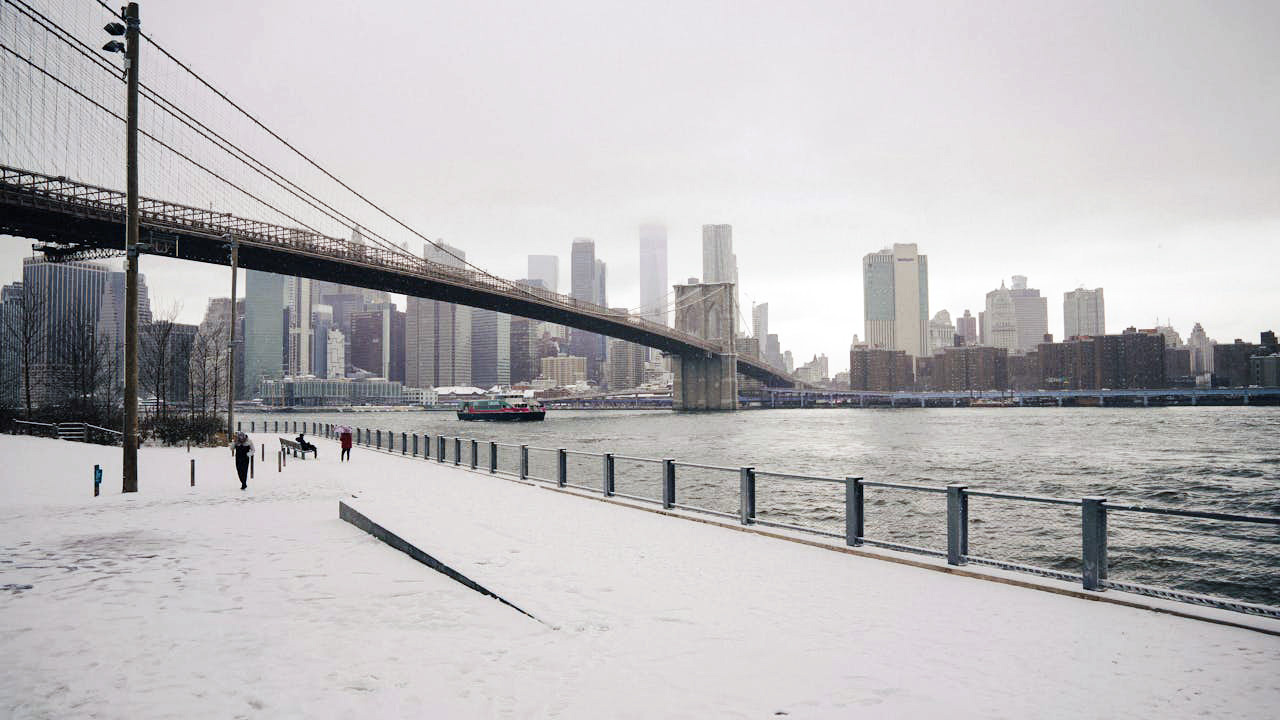
New York and the Northeast prep for a messy weekend of snow and ice
From the Hudson Valley to coastal New England, you are staring down a weekend that will feel less like a postcard and more like a stress test. Forecasts point to a volatile mix of heavy snow, sleet and freezing rain that will glaze roads, strain travel and complicate New Year plans across the region. The setup means you will need to think less about pretty flakes and more about timing, temperature swings and how quickly ice can turn routine errands into risky moves.
Storm setup: a volatile pattern over New York and the Northeast
You are dealing with a classic winter clash of air masses, with cold air locked in at the surface and a surge of warmer, moisture laden air riding up from the south. That combination is primed to wring out Snow, sleet and freezing rain across a broad swath of the interior, while coastal areas toggle between wet snow and a cold, soaking rain. For New York and its suburbs, the precise track of the low pressure system will dictate whether you spend more of the weekend shoveling or skating over black ice.
Forecasters are also watching the storm’s intensity, with a potential “bomb cyclone” scenario in play if the central pressure drops fast enough. A system that deepens rapidly can wrap in stronger winds and heavier bands of Snow, turning what might have been a sloppy nuisance into a disruptive event that tests power lines and tree limbs. Early guidance on this potential bomb cyclone underscores why you should not dismiss this as just another flurry filled weekend.
From flurries to whiteouts: where the heaviest snow is likely
If you live inland, you should prepare for meaningful accumulation rather than a cosmetic dusting. Earlier in the week, forecasters noted that Snow flurries could begin as early as Friday midday in New York City, with the more substantial burst of snow and ice arriving later as the storm matures. That timing matters for you because it shifts the worst conditions into the evening and overnight, when visibility drops and untreated surfaces are most treacherous, especially in and around New York City.
Farther south and east, projections show a corridor from New Jersey through Long Island that could see significant totals if the cold air holds. One detailed outlook describes a Snowstorm Forecasted to Bring Up to 9 Inches of Snow Across New Jersey, New York, and Long Island, a range that would be enough to bury side streets, overwhelm smaller plows and force you to rethink any nonessential driving. If you are in that zone, you should treat the phrase Inches of Snow Across New Jersey, New York, Long Island as a practical planning number, not a theoretical upper bound.
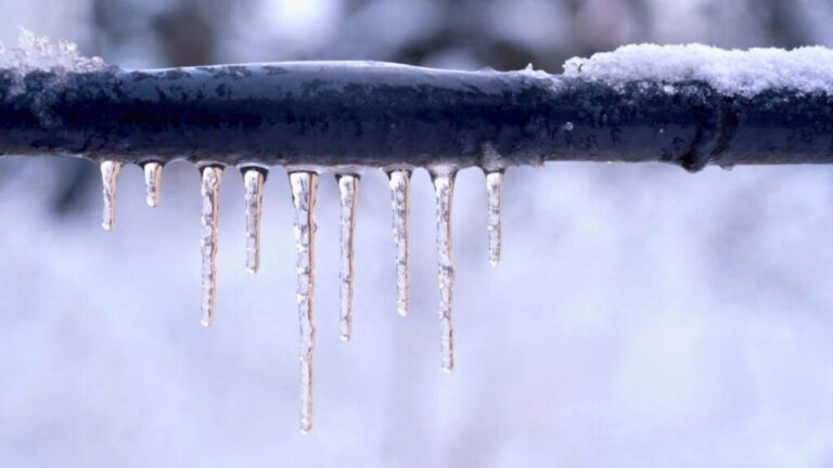
Ice, not snow, may be your biggest weekend hazard
Even if your backyard misses the bull’s eye for heavy snow, you are not in the clear. Forecasters are blunt that Ice is the biggest concern for areas across the Northeast, particularly where surface temperatures hover near freezing while warmer air rides overhead. That setup favors a prolonged period of freezing rain that can coat roads, sidewalks and power lines in a nearly invisible glaze, a threat highlighted in a regional Map showing forecast ice conditions.
Closer to the city, The NWS warns that black ice can form on roadways, bridges, overpasses and any untreated surfaces as temperatures dip below freezing behind the storm. That risk is not limited to rural backroads, it extends to major arteries and neighborhood crosswalks where you might assume crews have already salted. Local officials have been urging you to slow down, leave extra space and avoid sudden braking, particularly in the early morning hours when the NWS warns that refreezing is most likely.
Timing the worst of it: your weekend and New Year plans
The storm’s schedule matters as much as its strength, especially if you are trying to salvage travel or New Year traditions. Much of the wintry precipitation in the Northeast is expected to ramp up through the weekend, with the interior Northeast along the higher terrain most likely to see a mix of heavy snow and up to a quarter inch of ice on Monday. That means you could be dealing with lingering slick spots and cleanup well into the start of the workweek, according to a detailed outlook that notes how Most of the wintry precipitation will be concentrated in that window.
If you are eyeing the ball drop, the question Will New York City get snow for New Year has become more than small talk. Earlier guidance suggested that the winter storm that hit Friday evening into Saturday morning, Dec. 26 to 27, would leave behind snow and ice that could still be underfoot as you head toward New Year, especially on untreated sidewalks and subway stairs. That means even if flakes are not actively falling over Times Square, you will want to build in extra time and caution as you navigate crowds and slick pavement, a point underscored in a forecast that framed the issue as Will New York City get snow for New Year.
Travel trouble: airports, highways and holiday returns
If you are flying, you should brace for a ripple effect that extends well beyond your departure time. Newark Liberty International Airport, John F. Kennedy International Airport and LaGuardia Airport have already posted snow warnings as earlier waves of wintry weather snarled holiday travel across the Northeast and Great Lakes. With another system on the way, you can expect more delays, cancellations and long lines at rebooking counters, particularly at Newark Liberty International Airport and its New York counterparts.
On the ground, you are likely to see a repeat of the scene where Snow blowers hummed and snow shovels scraped sidewalks clear in Westchester County, New York, on a recent Saturday morning as several inches of snow accumulated overnight. Those local snapshots translate into regional slowdowns, with plow convoys, reduced speed limits and spinouts clogging key corridors from the New York State Thruway to I 95. If you must drive, you should build in generous buffers and remember that even treated highways can hide slick patches when Snow is falling faster than crews can keep up.
State of Emergency and official preparations
Officials are not waiting for the first icy crash or downed line to act, and you should take your cues from that urgency. A State of Emergency has been declared for New York and New Jersey as a multi hazard winter storm sweeps across the Northeast, a move that frees up resources, speeds up contracting and gives governors more flexibility to deploy crews. The same forecast warns that Winter Storm Ezra is expected to bring blizzard conditions and significant icing to the upper Midwest, Great Lakes and Northeast, underscoring that this is not a hyper local squall but a sprawling system that will test infrastructure across the Northeast.
Closer to home, city agencies are staging plows, brine trucks and tow operations in anticipation of blocked intersections and stranded vehicles. The Departmen of sanitation and transportation crews are coordinating with emergency responders to prioritize hospitals, bus routes and major bridges, while public works teams in suburbs from Long Island to the lower Hudson Valley are topping off salt domes and checking equipment. You may not see all of that preparation, but you will feel its impact in how quickly your street is cleared and how often you hear the scrape of plows overnight, a response shaped in part by earlier guidance from The NWS and local Long Island briefings.
Science, climate and the politics swirling around the storm
As you watch the radar light up, you are also seeing a collision between science and politics play out in the background. Scientists have been pushing back on a plan from President Trump to break up a critical climate and weather center, warning that weakening that capacity would undercut the very forecasts you are relying on to plan your weekend. Their concern is not abstract, it is tied directly to the kind of bomb cyclone now sending heavy snow, strong winds and hazardous travel conditions into the Northeast, a scenario detailed in coverage of how Scientists push back on Trump proposals.
For you, the takeaway is that the quality of your forecast is not guaranteed, it depends on sustained investment in satellites, supercomputers and the people who interpret their data. When a potential bomb cyclone is on the table, you want the best possible modeling of how quickly the pressure will fall, where the heaviest bands will set up and how the rain snow line will wobble over your neighborhood. That kind of precision is what allows meteorologists to warn that Freezing rain will move into Hudson Valley and New England Sunday late afternoon into the evening hours, with an Icy glaze expected for some in northern New England, a level of detail captured in a forecast that tracks Freezing rain across the region.
How to prepare your home, commute and weekend routine
With the broad outlines of the storm clear, your focus should shift to practical steps that reduce your risk. At home, that means charging devices, checking flashlights, stocking a modest supply of shelf stable food and making sure you have ice melt or sand on hand for steps and walkways. If you live in a building with older wiring or large trees nearby, you should think through how you would stay warm if a branch takes down a line, especially in neighborhoods where earlier storms left Snow piled up along curbs and narrowed streets, as described in reports By Leah Willingham and Julie Walker, Associated Press, that showed how quickly drifts can hem in central eastern Long Island and other coastal communities when Snow stacks up.
For your commute, the smartest move is often to avoid it. If you can work remotely or shift errands to a quieter window, you will spare yourself the stress of navigating slush filled intersections and black ice on overpasses. When you do have to head out, build in extra time, keep your gas tank at least half full and stash a basic kit in your car with a blanket, gloves and a small shovel, the kind of gear that proved invaluable when earlier storms left vehicles stuck as Snow flurries gave way to heavier bursts on Friday in New York City and beyond. Those earlier episodes, captured in coverage of Snow and ice across the region, are a reminder that even a few inches can upend your routine if you are not ready.
What happens after the storm passes
Once the last flakes taper off, your weekend is not automatically back to normal. The major weather alerts may expire through the morning as the remnants of the storm move out, but the main threat often shifts to lingering slick spots and a hard freeze that locks in whatever slush is left behind. In New York City, that pattern has already played out this season, with snow totals followed by temperatures staying below freezing Saturday and into the rest of the weekend, a combination that left side streets rutted and sidewalks uneven even after plows passed, as described in a local recap of how freezing temps locked in the snowpack.
For you, the days after the storm are when small decisions matter most. Choosing boots with real traction instead of sneakers, giving sanitation trucks room to maneuver, checking on neighbors who may struggle with shoveling or mobility, all of that shapes how quickly your block recovers. As another winter system lines up behind this one, with This ABC News graphic showing the expected winter storm path across the Midwest and Northeast, you are reminded that each round of snow and ice layers on top of the last. Treat this weekend not just as a one off disruption but as a rehearsal for the rest of the season, one where your preparation, patience and attention to detail can make the difference between a messy inconvenience and a genuine emergency.